
Flooding in the Thames is a threat that comes from both upstream and downstream
12th January 2022
World wide action to avert the worst effects of the climate crisis are aiming to keep global temperature rises to 1.5C. Whilst that is the target spoken about by governments and businesses, Climate Action Tracker, analysing actual actions being taken, predict that we are on track for a global temperature rise of 2.7C (https://www.bbc.co.uk/news/science-environment-59220687). This level of temperature rise will lead to a faster melting of ice caps and glaciers, causing sea levels to rise and more extremes bouts of weather, increasing the severity and frequency of floods.
Here in south east England sea levels are projected to rise by approximately 1.4m – a little under a meter if the temperature rise is brought below 1.5C (https://www.metoffice.gov.uk/research/news/2019/uk-sea-level-projections-to-2300). The Met office also predicts that 1 in 10,000-year flood events are likely to occur more than once a year by 2300.
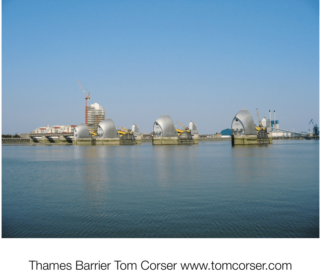
The Thames is tidal all the way up to Teddington Lock. At present the Thames Barrier is raised when ever there is a high tide that threatens to flood London. High tides are caused not just by the movement of the moon, nor by rising global sea levels. They are are also affected by weather systems. For example the height of a tide coming in from the North Sea can be increased by an on shore wind or by a low pressure system over the sea. Rising global temperatures that are causing rising sea levels and more frequent and intense weather systems means that the time will come when the Barrier will no longer be able to hold back an incoming high tide. The Corporation of London is considering plans to tackle this, including increasing the height of the Barrier and raising the height of the walls that bound the Thames – eg along The Embankment – by a further meter. There is debate as to whether this should be with glass so as not to obstruct the view of or from the river.
When the Barrier is raised to slow an incoming high tide, the water that is held back has to go somewhere – that is somewhere in the Thames estuary downstream of the Barrier. There is a flood storage area at Tilbury and on both sides of the Estuary there are area of marshland and farmland where flood waters can flow. These are in between other at risk built-up areas which have their own flood defences. Such provision will need to be reviewed as tide levels rise.
The Thames Barrier is also closed when there is a risk of flooding upstream. The Thames has a large drainage basin that extends all the way up into Oxfordshire and the Cotswolds. Heavy and/ or persistent rain anywhere in the area can raise river levels such that places such as Windsor, Thames Ditton, Richmond, Hammersmith risk being flooded. In such circumstances the Barrier can be raised at low tide, to prevent sea waters entering the lower part of the Thames so creating a reservoir where high volumes of water from upstream and be stored until the risk of flooding is lowered. The protection offered by this scheme is not going to be sufficient to cope with predicted rises in water levels due to the climate crisis.
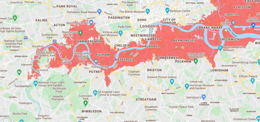
The following map shows areas of London that will lie below the anticipated annual flood level based on the IPCC’s climate change forecasts. (https://sealevel.climatecentral.org/maps/)
Boroughs along the Thames, such as Richmond, are having to develop plans to both limit or avert factors that contribute towards the risk of flooding and to constrain the adverse effects such flooding will cause. In part they will be dependant upon actions take by other people and organisations further upstream. For example, if further a.one the Thames, houses are built on the flood plain, then water that might otherwise be held or absorbed by that flood plain, will instead flow on down stream exacerbating the problem in Richmond. Similarly if surfaces that are currently – eg covered with grass and other vegetation – are replaced by hard surfacing such as tarmac, then again more water will flow more rapidly off the land and into the river. In a similar way areas of woodland are cleared, then less water will held in the land and instead will add to the volume in the river. Conversely recreating water meadows to allow flood waters to accumulate safely up stream, replacing hard surfaces with soft one, and planting trees, can all help reduce the volume and speed with which water drains off the land and into the river. In the Old Deer Park there are plans for the ‘re-wilding ’ of the land allowing formation of seasonal ponds/ lagoons and the growth of water-loving plants that increase the water absorbing capacity of the land. You can read more about this here – http://thames-landscape-strategy.org.uk/what-we-do/rewilding-arcadia/

One thought on “Green Tau: flooding in the Thames basin”